
Home > Utah and Nevada > Kolob Terrace Zion
Click on any image to enlarge and jump to that page.
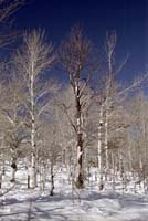
| Just where Kolob Reservoir Road meets the northern boundary of Zion National Park, there is a wonderful grove of birch trees. | |
| Three somewhat symmetrical trees in the grove, just off the road. And yes, the sky was that blue... well, that blue seen through a polarizer. | |
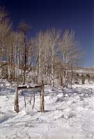
| Kolob Reservoir Road is only plowed up to Spend Love Knoll. There is a turnaround and a cross-country ski station, and then the road begins a good climb. This is a view looking down the hill where the sun keeps the snow level down. The snow gets quite deep and drifty past the park boundary as the meadow opens up. After a good snowstorm, Lava Point is simply not reachable in a wheeled vehicle. | |
| Spend Love Knoll. I like the name as much as the mountain. The lumps of snow are buried clumps of grass. | |
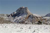
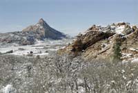
| A peak well off the road. I suspect this is 'Red Butte,' but it could be 'Burnt Mountain' just as well. GPS doesn't work as a good compass when standing still... | |
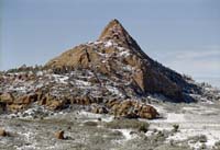
| Another view of Red Butte or Burnt Mountain. If you know which is which, please fill me in. | |
Home > Utah and Nevada > Kolob Terrace Zion
All rights reserved. Copyright (C) 1991-2005, John Kalucki.
Please send comments, suggestions, and re-use requests to:
![]()