
This is probably a parhelia, commonly known as a sun dog.
Home > Utah and Nevada > Top 20
Click on any image to enlarge and jump to that page.
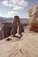
| Delicate Arch, one of the symbols of Utah, in Arches National Park. | |
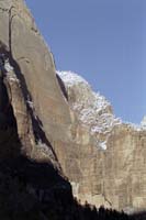
| Early morning in Zion Canyon, Zion National Park, Utah. | |
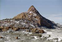
| A peak on Kolob Terrace, the highlands of Zion National Park. | |
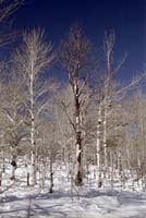
| Birch trees in Kolob Terrace, Zion National Park, Utah. | |
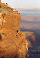
| A sunset-lit cliff at Grand View Point, Island in the Sky, Canyonlands National Park, Utah. | |
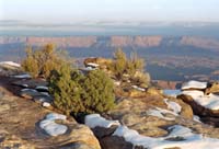
| Another view at Grand View Point, Island in the Sky, Canylonlands National Park. | |
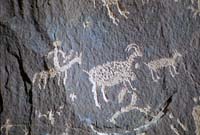
| The area around Moab, Utah sports many rock carvings known as petroglyphs. This little guy and his big fat prey are from Newspaper Rock State Park, Utah. | |
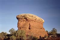
| One of only about a million similar outcroppings in the Elephant Hill area of Canyonlands National Park. | |
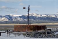
| A rancher's windmill and water tank south of Ely, Nevada. | |
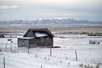
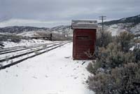
| A cattleman's shelter adjacent to a cattle pen in Eastern Nevada. | |
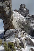
| One end of the Lexington Arch in Great Basin National Park, Nevada. | |
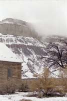
| Low clouds cover Caineville Reef, just east of Capitol Reef National Park, Utah. | |
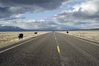
| Cattle range freely along and across the roads in the virtually unpopulated Snake, Pine and Wah Wah Valleys of Western Utah. | |
|
A very strange rainbow-like formation over the
Bonneville Salt Flats in Utah.
This is probably a parhelia, commonly known as a sun dog. | |
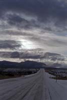
| A stormy sunrise near Ely, Nevada. | |
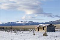
| A lone cabin along the "Loneliest Highway in America", US 50. This view is across Jakey Valley, Nevada. | |
| Soldier Summit, Utah -- just one of the many summits I traveled over in ten days on the road. | |
| The end of the ore-cart track at the Paymaster Mine, part of the Ward Mining District, near Ely, NV. | |
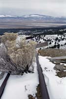
| A railway at the BHP Copper mine, Ely, Nevada. | |
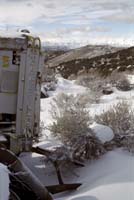
| An old Caterpillar tractor at the Black Forest Mine, Nevada. | |
Home > Utah and Nevada > Top 20
All rights reserved. Copyright (C) 1991-2005, John Kalucki.
Please send comments, suggestions, and re-use requests to:
![]()