The Shafter Trail (AKA South Fork road, AKA Potash Road) leads from Moab to Canyonlands via the direct route- along the Colorado River gorge and up the side of a serious cliff.
The trip starts off paved until you get to a mine and some very large, somewhat nasty, tailing ponds. Venturing through the cleanup site, the road gets a bit rough. Just a little something to get you started...
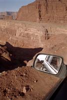
After some great views of the Colorado river gorge, the road comes right up to the cliff at the 'Goose Neck'. Here the passenger's side of the Jeep (out of view) is within 6 inches of the base of a cliff.
The driver's side mirror, shown here, is within about 2.5 feet of the top edge of a sheer cliff. Big deal, right? Err, no. That's a ~1000 foot drop, straight down, and right into the river!
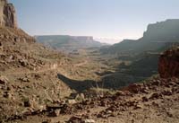
A view of Shafter canyon, looking east towards the river. The trail can be made out on the left-most side of the frame, disappearing into the middle of the frame.
Now the real climbing begins! I'm sure in the summer this drive is No Big Deal, but in the winter...
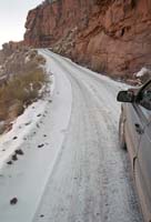
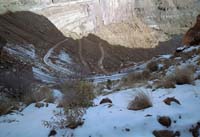
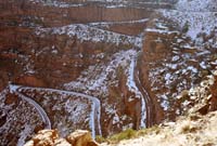
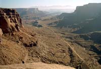
The view from the top, as seen after winding up the hill the hard way.
After a mile or so, the trail connects with the paved park system road.